
Plans to Pair it With Other Sensors to Conduct Research Using Three Wavelengths, and Also Perform Shallow Water Bathymetric Analysis
February 2021
Long-time RIEGL systems user, Finnish Geospatial Research Institute (FGI), has recently added the compact RIEGL VQ-840-G airborne laser scanner to its already impressive collection of sensors. True scientists, FGI innovators are moving the 3D industry forward in new ways that will prove very interesting to watch. In the coming year they will be teaming up with other researchers around the world to work on projects involving forest health, wetlands restoration, glacier change detection, optimization for autonomous vehicles, and modeling for autonomous vehicles, and modeling for smart cities.

With the addition of their new RIEGL VQ-840-G, FGI will be able to add more depth to the scientific techniques in their portfolio in two distinct ways:
- pairing it with other airborne scanners to obtain information in multiple wavelengths (visible and infrared) and,
- obtaining bathymetric datasets of shallow water bodies such as river beds, coastal areas, and peatland drainage.
Scanning in Three Wavelengths
FGI plans to pair their new VQ-840-G laser scanner with others in their kit: RIEGL’s miniVUX-1DL, the VUX-1HA, and the VQ-480-U to conduct multi-spectral wavelength collections.

FGI Research Professor, Dr. Antero Kukko, is creating a custom platform that will hold three different sensors and can be mounted onto a helicopter. The operator and scanning equipment can be deployed to whatever location is desired, and then enlist the services of a local helicopter flight service. In this way, within one singular flight there will be three LiDAR scanners collecting high-resolution 3D data simultaneously in three distinctly different wavelengths.
Why three wavelengths? Each wavelength offers different qualities for scientists including enhanced 3D geometric and radiometric properties, scattering or echo properties of each pulse, and reflectance.
Dr. Kukko explained, “These characteristics have typically been collected through passive imaging by remote sensing or hyper-spectral imaging. But what we hope to do now is to remove some of the potential error sources such as sunlight dependency or elevation or object geometry variations. With LiDAR scanning simultaneously in three different wavelengths we can even out some of these factors.” He continued, “A single wavelength is pretty narrow so with only one sensor’s wavelength it’s a somewhat limited sample. When you add more wavelengths you can use that extra data to make more advanced characterization of surfaces/objects being measured. It gives you more tools for interpretation.

As an example, FGI plans to use this three-scanner system on projects like determining forestry health and documenting tree growth patterns. The data from the three scanners will capture information from the canopy to the ground and will provide information to researchers on characteristics including:
- tree species classification,
- rock formations,
- moss and subdominant and under-vegetation,
- wetness of the ground,
- slopes,
- impacts of climate change,
- impacts of insects or disease.
Governmental agencies and private forestry leaders are eager to receive this wealth of information. Kukko said, “We want to demonstrate and foster applications of this data, and further improve the efficiency and spatial coverage of this type of airborne laser data. In Finland there exists an open source of free and accessible nationwide laser data, and authorities are using this data on a daily basis. So the information is already available but we want to continue to improve it. For instance, if we can perform a tree growth analysis through the years, from season to season, it could be valuable in many ways. We can combine LiDAR data with field sampling of the nutrients and soil moisture for a more complete understanding of the forest. This multi-wavelength technique has applications beyond what we can imagine today, but two obvious uses are predicting future forest growth or how it might respond after a fire.”
Bathymetric Scanning of Shallow Water Bodies
The VQ-840-G is a low altitude bathymetry sensor with a 40 degree field of view (FOV) from two different angles. Viewing water bodies from different angles increases the likelihood of LiDAR penetration beneath the water’s surface and towards the bottom. Another unique feature of the sensor is its ability to capture the full waveform of the outgoing pulse. This allows for waveform stacking and also increases the depth of water penetration. The system can be paired with a camera or single point range finder.
A key application planned for FGI’s new VQ-840-G is to use it for bathymetric research in areas of shallow water such as wetlands (swamps, marshes and bogs), riverbeds and coastal areas.
FGI has been able to obtain underwater surface data using sonar obtained via boat. But shallow areas such as marshes, riverbeds or near coastal shorelines are harder to capture. Professor Kukko gave an example, “Rivers, a natural habitat for salmon in the Finnish arctic are quite shallow so there is too little water for the survey boats to float over them. By using the green wavelength of the VQ-840-G we should be able to fill in the missing information and complete these models.”

FGI’S Planned Bathymetry Projects
Wetlands
A future project to watch will be the creation of a detailed geological survey including measurements of drainage areas in the wetlands of Finland’s forests. “The forests have many man-made ditches that are diverting water, hummus and nutrients, and affecting the ecosystems in Finland and the Baltic Sea. There is a restoration effort underway and detailed elevations and maps will be quite useful,” said Dr. Kukko. This strategy could be shared with other governments around the world with similar wetland areas when they are planning a restoration.
Rivers
Arctic rivers have a heavy discharge when the snow melts, but more of the time it is quite shallow and the water is more clear. Kukko said, “Turbidity of the water has an effect on how deep we can see through the water body. We recognize that there are limits to what we can see with the VQ-840-G, and we want to understand what exactly is possible with this equipment through experimentation. Having the equipment readily available when the water is more clear will make capturing data about these rivers possible.”

Coastal
Finland has 1,250 km / 780 miles of vastly diverse coastal geography. There are a lot of shallow sea areas in the west, and areas in the north that have and continue to experience land uplift – a post-glacial rebound that should be monitored. There are areas off the southern coast that are typically quite muddy but have periods of water clarity. These coastal areas are all important for their biodiversity, as well as their fisheries and seafaring navigation. With the VQ-840-G FGI will map these areas at times when there is lower turbidity, at greater frequencies, or after a major weather or other event. These data sets will inform researchers of the health of both sea and inland, and analyze and predict wave patterns
2021 FGI Research Plans Elsewhere

FGI has teamed on research projects in Canada, United States, Japan, Sweden, and numerous European countries. Many of the projects focus on improving forest and vegetation information for structural analysis, quality of the timber, forest health and forest fire risk assessments.
In addition to forestry applications, FGI will continue to be involved in geomorphology research and characterization of diverse terrain features like volcanic landscapes, fluvial and coastal systems, and glaciers using high resolution 3D data. They also work with scientists who are doing planetary studies to interpret other remote sensing data such as satellite radar.
An exciting project planned for late 2021 is Antarctic sea ice and glacier measurement and surface modeling that includes the roughness of snow and ice, snowpack, and

other glacier topography that will be compared with data collected by NASA’s ICESat-2 (ice, cloud, land elevation satellite and in-situ sample, and snow albedo data). This project will likely be performed using the RIEGL miniVUX-1DL on a drone for wide area topography and kilometers long transects over the snow pack and sea ice.
In the field of autonomous driving, FGI has plans to continue its research on the using LIDAR technologies for perception, autonomous navigation, and high-definition mapping of road and urban environments.
As a part of a National Land Survey of Finland, FGI conducts research and development of automated data collection and processing technologies and methodologies for future operational mapping and monitoring purposes.
About the RIEGL VQ-840-G

This compact scanner has excellent applications for hydrographic and topographic surveying and can be mounted on a UAV, fixed-wing aircraft, or a helicopter. FGI was interested in obtaining the VQ-840-G because of its unique green wavelength, as well as its applications for shallow water research.
The VQ-840-G can operate at a temperature range of -10°C / 14 °F up to +40°C. / 104 °F. This means FGI will have no problems using the system in the typical environments they plan to study. “It’s good that it can operate in below-freezing temperatures because we are interested in the physics of snow and ice. We do occasional research on snow and temperature effects on power lines. And conversely, a few years ago we did a project in Idaho, United States in August at a Mars terrestrial analog called Craters of the Moon National Park. It was the hottest time of the year there, and we had no trouble with the equipment,” said Dr. Kukko.
The RIEGL VQ-840-G has a few optional features including an integrated inertial navigation system, a fully integrated infrared laser rangefinder, and an integrated digital camera. FGI did not purchase these options because they have those features already in other RIEGL scanners in their toolbox.

About Finnish Geospatial Research Institute (FGI)
FGI is the research arm of the country’s National Land Survey of Finland organization (NLS). NLS performs all the various kinds of cadastral surveys in Finland and produces open-source (free and freely available) and information-rich maps. FGI is a very exciting part of this massive government agency as they have access to the latest in survey technology and are assigned forward-thinking projects that could benefit society in the future.
FGI Collaborates with Researchers Around the World
FGI collaborates with teams around the world to conduct pioneering research of the earth: forests and marshes, riverbeds, glaciers, lava tubes and even urban areas. While FGI is a part of the Finnish governmental organization, the research teams are often invited to join research projects in other countries. When FGI can provide the right equipment or expertise to round out the team, the efforts are supported. In just the last ten years FGI has worked on projects in collaboration with others worldwide involving:

- forestry and agriculture health,
- autonomous vehicles operation in snow-covered conditions, or finding ways to better handle massive amounts of AV data,
- 3D modeling of forests, agriculture areas, Smart Cities, roads, power-lines and rivers for utilization in the public and private sector,
- climate change – sea level rise of the Antarctic ice sheet,
- Quality4Roads automated distress detection system to quantify the quality of road surfaces.
- SILS individual tree and canopies – carbon intake and water balance measurements obtained with remotely sensed data,
- Spectrophotogrammetry experiments worldwide requiring reflectance.
Professor Antero Kukko said that it hard to pin him down to one specific type of project they would consider. He explained, “We like getting involved in research that has not been done before. So we look for projects that require innovation and new approaches.” He continued, “Over the years we have built a network of fellow researchers from around the world. Conversations take place and lead to ideas about how we could solve problems. For this kind of research we all need to have the capacity to take some risk to prove a concept. We say, ‘This is the way it could work’. If the concept is sound, we collaborate to make proposals and obtain funding to move forward.” Dr. Kukko and his colleagues at FGI are open to these types of conversations with universities, space agencies, and public and private research organizations from every continent. They are also actively hiring new members to work within their organization.

Meet Professor Antero Kukko, D.Sc.
Research professor of Mobile Mapping at the Centre of Excellence in Laser Scanning Research, Finnish Geospatial Research Institute, National Land Survey of Finland, and Adjunct professor, Mobile Laser Scanning and Land Use, Department of Built Environment, School of Engineering, Aalto University
Dr. Kukko is among about 30 colleagues at the Centre of Excellence in Laser Scanning at NLS. His main research topics involve mobile laser scanning and airborne scanning with helicopter and drones. He also has a Ph.D. in photogrammetry. He has been involved in the geospatial industry since 2002.
His research utilizes the latest in multispectral mobile and airborne laser scanning systems for a variety of applications including but not limited to: autonomous driving, road and built environment, land use, forestry, agriculture, climate change and change detection. He is always looking for ways to advance the performance of the technology.
He has won many awards for his work on remote sensing, and has innovated multiple-wavelength laser mapping systems for airborne and mobile platforms. In 2004 he pioneered the Roamer MLS system. In 2010 he invented the Akhka mobile laser system backpack. He has written a plethora of peer-reviewed international journal articles and papers, and is or has been a professor or guest lecturer at universities in Austria, China, Brazil, Japan, and of course Finland.

About Nordic Geo Center Ltd
FGI purchased their 840-G airborne laser scanner from Nordic Geo Center Ltd, a RIEGL distributor serving Finland, Estonia and Sweden. The company also trains its customers to use their sensors to achieve good results.
Hannu Heinonen, the founder of the company, has worked with surveying instruments since 1970’s. Hannu studied in Finland and received additional training in geodesy, optoelectronics and photogrammetry in Heerbrugg, Switzerland. One of his earlier companies developed total station software for surveying applications. Mr. Heinonen has also participated in the development of the world’s first freely programmable total station (based on Hannu’s idea) with Nikon Corporation in Japan and consequently with a similar instrument with Zeiss in Germany. In the early days of static laser scanners, Hannu contributed to the development of certain RealWorks Survey algorithms for Mensi in France.
Since 2014, Nordic Geo Center Oy has tested and developed the use of REIGL VMX mobile laser scanning in road measurements together with REIGL Laser Measurement Systems, Austria.
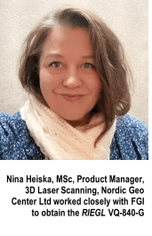
Nina Heiska, product manager at Nordic Geo Center Oy, was a helpful resource during the writing of this article. Nina has a master’s degree in archeology from the University of Helsinki, and bachelor’s degree in Laser Scanning from Evtek University of Applied Sciences. She has worked and studied in several countries including Italy, Jordan, Austria and UK.
Nina has worked for the past six years under the guidance of M.Sc. (Eng) Tauno Suominen, who has a quarter-century of experience with airborne and mobile laser scanning including the development of helicopter-based scanning and software for road infrastructure projects in the late 1990s.
Currently, Nina is in the steering group of VTT coordinated 3D LIDAR ecosystem project which develops LiDAR – both components from light sources and electronics to micro-mirrors and a MEMS scanner in Finland. VTT’s LiDAR’s application is for use in autonomous vehicles, and also machine control systems that will be equipped with scanners in the future.
#END#
To view this document in PDF format, please click below.
Finnish Geospatial Research Institute Adds RIEGL VQ-840-G to their Airborne Toolbox

About RIEGL:
RIEGL is an international leading provider of cutting-edge technology in airborne, mobile, terrestrial, industrial and unmanned laser scanning solutions.
RIEGL has been producing LiDAR systems commercially and focuses on pulsed time-of-flight laser radar technology in multiple wavelengths.
RIEGL’s core technology, the digitization of LiDAR signals (“Waveform LiDAR”), provides unique methodologies for resolving range ambiguities, multiple targets per laser shots, optimum distribution of measurements, calibrated amplitudes and reflectance estimates, as well as the seamless integration and calibration of systems.
RIEGL’s Ultimate LiDARTM 3D scanners offer a wide array of performance characteristics and serve as a platform for continuing Innovation in 3D for the LiDAR industry.
From the first inquiry, to purchase and integration of the system, as well as training and support, RIEGL maintains an outstanding history of reliability and support to their customers.
Worldwide sales, training, support and services are delivered from RIEGL’s headquarters in Austria; main offices in the USA, Japan, China, Australia and Canada; and a worldwide network of representatives.