A broad portfolio of RIEGL point cloud samples is now live in POTREE!
POTREE is a free and user-friendly open source software and has gained a significant market share in the last couple of years. The purpose of POTREE is to be able to stream massive LiDAR point clouds online. When you click on the link, the chosen dataset will open and be visible on your screen. For more information on POTREE, please visit potree.org.
In our Demo Data Section, you will find point cloud samples of various applications using the extensive portfolio of RIEGL laser scanners and systems. Please note when you click the link, you must agree to the disclaimer on the screen before you can access our interesting datasets.
Click here for RIEGL POTREE Datasets
See below for a list of some of our data examples available now to you in POTREE:
Terrestrial Laser Scanning
• RIEGL VZ-400i | Castle
• RIEGL VZ-400i | Ice Cave “Eisriesenwelt Werfen”
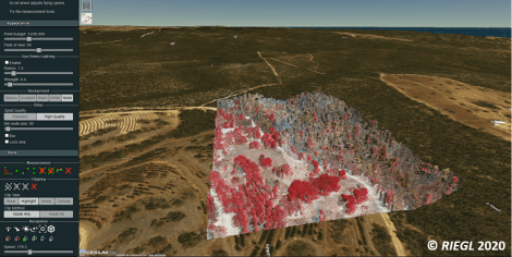
• RIEGL VZ-400i | Tree
• RIEGL VZ-4000 | Open Pit Mine
Airborne Laser Scanning
• RIEGL VQ-780i | City
• RIEGL VQ-1560 II | City
• RIEGL VQ-840-G | Lake
UAV-based Laser Scanning
• RIEGL VUX-1UAV | Monastery Göttweig
• RIEGL miniVUX-1DL | Power Lines
• RIEGL miniVUX-1UAV | Racetrack
• RIEGL miniVUX-2UAV | Concrete Factory
• RIEGL VUX-240 | Power Lines
• RIEGL VQ-840-G | Lake
Mobile Laser Scanning
• RIEGL VMX-1HA | Freeway
• RIEGL VMX-2HA | Highway
• RIEGL VMX-RAIL | Railway Track
Customer Data – Special Projects
• Airborne Research Australia, RIEGL LMS-Q680i | Forest Fires on Kangaroo Island
Enjoy browsing and exploring the fascinating point clouds!
About RIEGL
RIEGL is an international leading provider of cutting-edge technology in airborne, mobile, terrestrial, industrial and unmanned laser scanning solutions.
RIEGL has been producing LiDAR systems commercially for over 40 years and focuses on pulsed time-of-flight laser radar technology in multiple wavelengths.
RIEGL’s core Smart-Waveform technologies provide pure digital LiDAR signal processing, unique methodologies for resolving range ambiguities, multiple targets per laser shots, optimum distribution of measurements, calibrated amplitudes and reflectance estimates, as well as the seamless integration and calibration of systems.
RIEGL’s Ultimate LiDARTM 3D scanners offer a wide array of performance characteristics and serve as a platform for continuing “Innovation in 3D” for the LiDAR industry.
From the first inquiry, to purchase and integration of the system, training and support; RIEGL maintains an outstanding history of reliability and support to their customers.