
Editor Note: This customer spotlight is on Leading Edge Geomatics, a New Brunswick-based remote sensing & geomatics company, who utilize RIEGL airborne solutions for forestry and other applications.
Leading Edge Geomatics is a New Brunswick based company that provides aerial survey and geomatics services across North America.
To date, they have flown over 100,000 km² of LiDAR data acquisition, and more than 90,000 km² of aerial photography.
Utilizing a fleet of five aircraft and seven digital sensors, including the RIEGL LMS-Q680i, LMS-Q780, and VP-1 airborne systems, Leading Edge offers customized solutions to clients across a number of industries including forestry.
“The RIEGL family of long-range airborne laser scanners makes use of a powerful laser source, multiple-time-around (MTA) processing, and digital full waveform analysis. This combination allows the operation at varying flight altitudes and is therefore ideally suited for aerial survey of complex terrain. The RIEGL sensors also give access to detailed target parameters by digitizing the echo signal online during data acquisition, and subsequent offline waveform analysis. This method is especially valuable when dealing with difficult tasks, such as canopy height investigation or target classification. Multiple-time-around processing allows the utilization of target echo signals which have been detected out of the unambiguity range between two successive laser pulses.” said Mike Oliver, Vice President of Corporate Development at Leading Edge.

Raw point cloud
Leading Edge has developed a Forest Management Solution, which integrates Enhanced Forestry Inventory with LiDAR terrain and surface products. The solution was developed with airborne remote sensing expertise, GIS application development experience and forest industry know how: a combination that is unique to Leading Edge.
“The accuracy and timeliness of the LiDAR data provide forestry organizations an alternative to legacy inventory methods that are limited in accuracy and detail necessary to make tactical and operational decisions.” said Oliver.
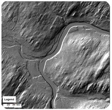
DEM
Their Forest Management Solution offers forest professionals the combination forest metrics and terrain data that lead to improved management strategy and efficient operations on the ground to increase profitability of forest resources.
The Forest Management Solution that Leading Edge has developed enhances the knowledge of a land base for forest managers, as well as operators, and allows them to:
- Lower operational costs
- Identify high value wood products
- Analyze variation in forest growth and performance
- Increase safety
- Reduce negative environmental impacts
- Improve change detection
- Predict accurate forest metrics accounting for within stand visibility across the landbase
- Improves operations and strategic planning
Leading Edge’s Enhanced Forest Inventory (EFI) is developed through a combination of spectral and LiDAR data, combined with a series of field plots. It is based on remote sensing capability, in-house forestry expertise, and practical experience working with forestry companies and organizations. The EFI is unique in the sense that it provides information that was previously unavailable, prohibitively expensive to collect, or not assimilated in a manner coherent enough to make decisions.

Canopy Height Model
“The LiDAR data process enables calculation of forest metrics to produce improved inventories and enables the production of terrain products to improve operational planning. The combination has resulted in reduced time and cost for road building, harvest planning and forest management planning.” said Oliver.
RIEGL is proud to work with and support Leading Edge in their LiDAR data acquisition!
